Geology

Geology Focused  River Trips

New Paragraph

Explore the Varied & Dynamic Geology of the Northwest

The diverse landscape of Oregon and the Northwest has been shaped over millions of years by eruptions, colliding tectonic plates, floods and earthquakes. From the volcanoes of the Cascade Range across the expansive Columbia River Flood Basalts and into the catastrophic flood-carved canyons of eastern Oregon, the scale and diversity of the geologic landscape is truly spectacular. 


Whether you are an avid geology enthusiast or simply curious about the remarkable geologic features that define Oregon, our geology-focused river trips cater to all levels of interest and expertise. Our expert geologists will narrate the trip, leading interactive discussions and giving fascinating presentations.


The itineraries and details for each trip are the same as for our standard trip of the same length and include comfortable camps, delicious meals, all rafting and camping equipment and knowledgeable and engaging guides.

Owyhee River

5 days - rome to birch creek

April 9 - 13, 2024

Geology  Focused with Dr. Gordon Grant

$1,879.00 (Adult)

Minimum age for this trip is 12


The geology of the Owyhee River Canyon is a wonderfully complex cornucopia of cataclysm. The river's steep-walled canyons and valleys record 5 million years of geologic drama and intrigue. The small but mighty Owyhee has faced epic and repeated struggles against lava flows, landslides while conveying catastrophic outburst floods from the lakes they create. It has also conveyed at least one immense flood from catastrophic overflow from a huge late Pleistocene lake beyond its watershed.


Lava has repeatedly entered the Owyhee Canyon and filled it creating wedge-shaped dams of solid basalt. The Owyhee takes 10,000s of years to cut through the lava dams and pass the sediment once held in their lakes.  In addition, landslides collapse from canyon walls  dumping immense loads of bouldery debris directly into the river's path. They are no match to lava dams and their lakes quickly  breach creating catastrophic floods leaving impressive boulder bars and erosional scars in their wake.


Stretches of steep canyon walls composed of thick layers of massive basalt and rhyolite alternate with stretches carved through dramatic and colorful badlands composed of lake sediments, thin lava flows, dikes, sills, and volcanic ash. The entire landscape is a testament to the sheer persistence of the river.

Owyhee River

5 Days - rome to birch creek

April 16 - 20, 2024

Geology  Focused with Dr. Kyle House

$1,879.00 (Adult)   

Minimum age for this trip is 12


The geology of the Owyhee River Canyon is a wonderfully complex cornucopia of cataclysm. The river's steep-walled canyons and valleys record 5 million years of geologic drama and intrigue. The small but mighty Owyhee has faced epic and repeated struggles against lava flows, landslides while conveying catastrophic outburst floods from the lakes they create. It has also conveyed at least one immense flood from catastrophic overflow from a huge late Pleistocene lake beyond its watershed.


Lava has repeatedly entered the Owyhee Canyon and filled it creating wedge-shaped dams of solid basalt. The Owyhee takes 10,000s of years to cut through the lava dams and pass the sediment once held in their lakes.  In addition, landslides collapse from canyon walls  dumping immense loads of bouldery debris directly into the river's path. They are no match to lava dams and their lakes quickly  breach creating catastrophic floods leaving impressive boulder bars and erosional scars in their wake.


Stretches of steep canyon walls composed of thick layers of massive basalt and rhyolite alternate with stretches carved through dramatic and colorful badlands composed of lake sediments, thin lava flows, dikes, sills, and volcanic ash. The entire landscape is a testament to the sheer persistence of the river.

John Day River Geology

John Day River

4 days - service creek to clarno

June 3-6, 2024

Geology  Focused with Dr. Emily Cahoon

$1,259.00 (Adult)

$1,209.00 (Youth - 6 to 12)


The John Day River basin includes a variety of geologic phenomena, from scraps of ancient islands and coral reefs to remnants of 45-million-year-old volcanoes and the southern-most exposures of vast lava flows that covered the Columbia basin.


The colorful story of Oregon’s geologic history is evident in the rugged landscape of the Clarno Volcanics, the colorful, ash-laden volcanic layers of the John Day Formation and the dark basalt flows that cap most of the landscape.


The section of the river corridor between Service Creek and Clarno best features the Clarno Formation rocks which are the remnants of Eocene volcanoes. The climate of the Eocene was sub-tropical, with heavy rainfall each year.  Clarno volcanic rocks are similar to those of the modern Cascades with the most common rock types being  andesites, lahars or volcanic debris flows, basalts and dacites.


Deschutes River

3 Days - TROUT CREEK TO MAUPIN

July 23-25, 2024

Railroad History & Geology Focused Trip with

William Burgel

$995.00 (Adult)   

$945.00 (Youth - 7 to 12)


Geology - Geology on the Lower Deschutes River is characterized primarily by Columbia River Basalt Flows. Occurring 14 million to 17 million years ago these massive eruptions covered significant portions of eastern Oregon and Washington with layer upon layer of lava. The Deschutes River maintained its northward course to the Columbia River by carving a canyon through these successive layers. The river canyon has also been affected by more recent events including massive landslides that blocked the river for a time some 10 to 14 thousand years ago and massive floods 3 to 4 thousand years ago. A substantial amount of the alluvial deposits from these floods remain unchanged to this day.


Railroad History - The railroad history along the Deschutes River is a tale of pioneering spirit and industrial ambition. In the late 19th and early 20th centuries, rail lines were laid along the river's rugged canyon, connecting remote settlements and facilitating the transport of timber, agricultural goods, and minerals. The Oregon Trunk Line, completed in 1911, stands as a testament to this era, carving through the challenging terrain and playing a vital role in the economic development of the region. Today, while much of the railroad infrastructure has evolved or disappeared, remnants of this history still dot the landscape, serving as a reminder of the transformative impact of transportation on the communities along the Deschutes River.

Lower Salmon River

4 Days - Hammer creek to snake river

August 25 - 28, 2024

Geology Focused with Dr. Gordon Grant

$1,629.00 (Adult)   

$1,579.00 (Youth - 7 to 12)


Geology - The Lower Salmon River winds through a deep, impressive canyon whose rock walls and valley deposits record over 200 million years of western North America’s geologic history. The ancient rocks tell a story of how volcanic islands and their associated assemblages of mud, sediments, and volcanic debris, were repeatedly rammed against the stable North American craton by plate tectonics. Over subsequent tens of millions of years these rocks were altered, sheared, cooked, tilted, uplifted and generally mistreated; this was followed more recently by massive incursions of Columbia River Basalt flows around 15 million years ago. The river has exposed this history, revealing the dramatic and picturesque landscape we see today.


Archaeology – The Lower Salmon Canyon is also the earliest known occupation site by humans in North America. The Cooper’s Ferry site, which we will visit, has recently produced artifacts and evidence of human settlement approximately 16,000 years ago. Here, people kindled fires, sharpened stone points and blades, and cooked large mammals. This evidence also suggests that the first occupants of North America traveled by sea and up rivers, at least 1000 years before melting glaciers opened an ice-free corridor through Canada. 


Rogue River

4 days - almeda to foster bar

September 11 - 14, 2024

Geology  Focused with Dr. Gordon Grant

$1,559.00 (Adult)

$1,509 (Youth - 7 to 12)


Arising in the Cascade Mountains, the Rogue River flows through the geologically young volcanic rocks of the High Cascades and the varied lavas and ash tufts of the older Western Cascades.  After entering the Klamath-Siskiyou Mountains, the Rogue carves a dramatic canyon through some of the oldest geologic formations in Oregon. Our trip will carry us through a chaotic mixture of metamorphic rocks, altered volcanic flows and marine sediments that have been folded, crumpled and slammed against the North American continent by plate tectonics.


The Rogue Formation, characterized by erosion-resistant metavolcanic rock such as quartz, serpentine and gneiss and is the most common in the canyon and is best illustrated by dramatic Rainey falls. The Rogue formation is interrupted by the Dothan Formation, characterized by sedimentary rock such as marine sandstone, siltstone and mudstone.  Mule Creek Canyon provides a dramatic example where the river finds an ancient fault line with the Dothan formation along the left and the older Rogue formation on the right.


Towards the end, the youngest and most easily eroded Flournoy formation emerges, comprised marine sedimentary rocks and conglomerates.


Meet Our Specialists
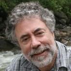
Dr. Kyle House

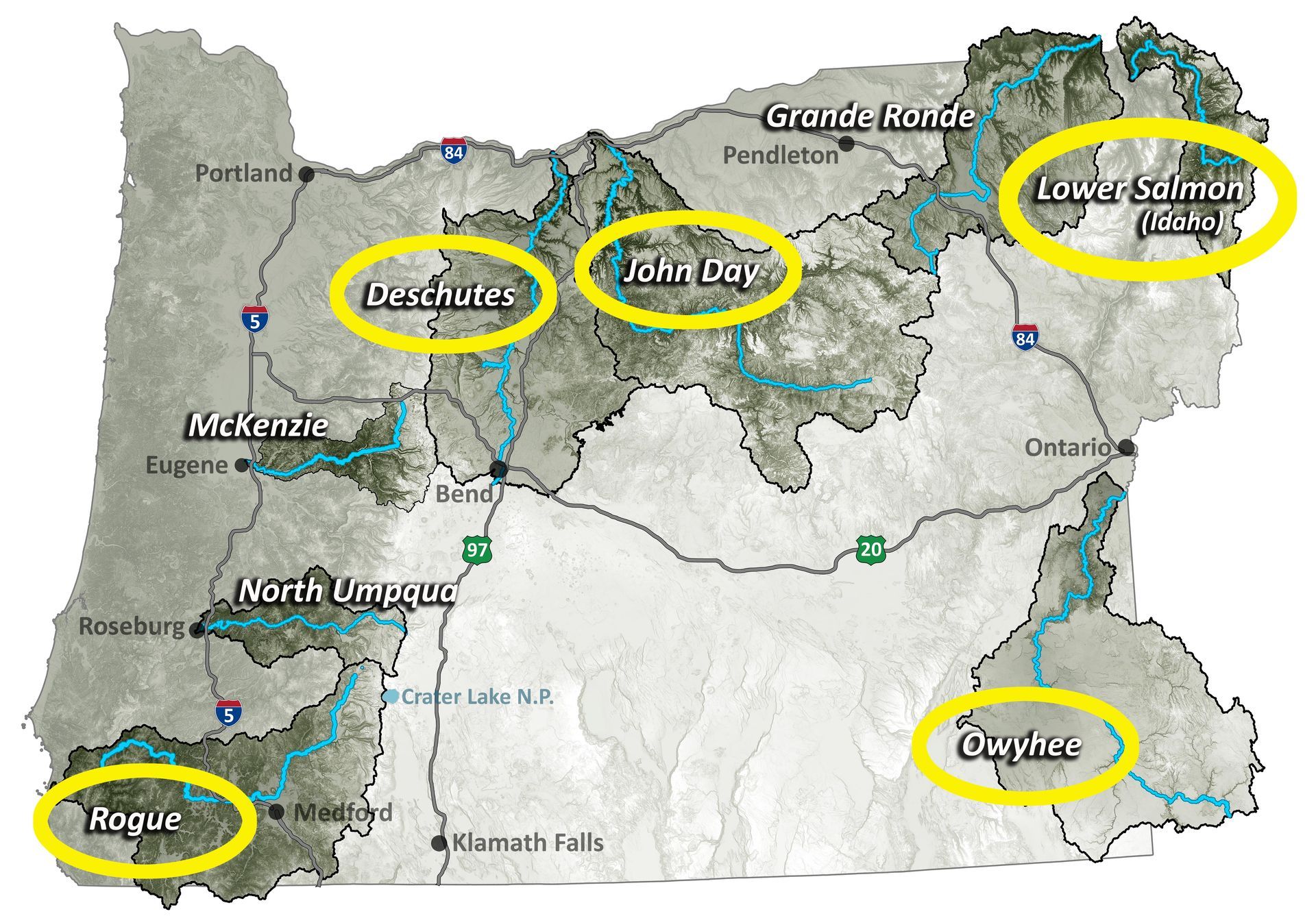
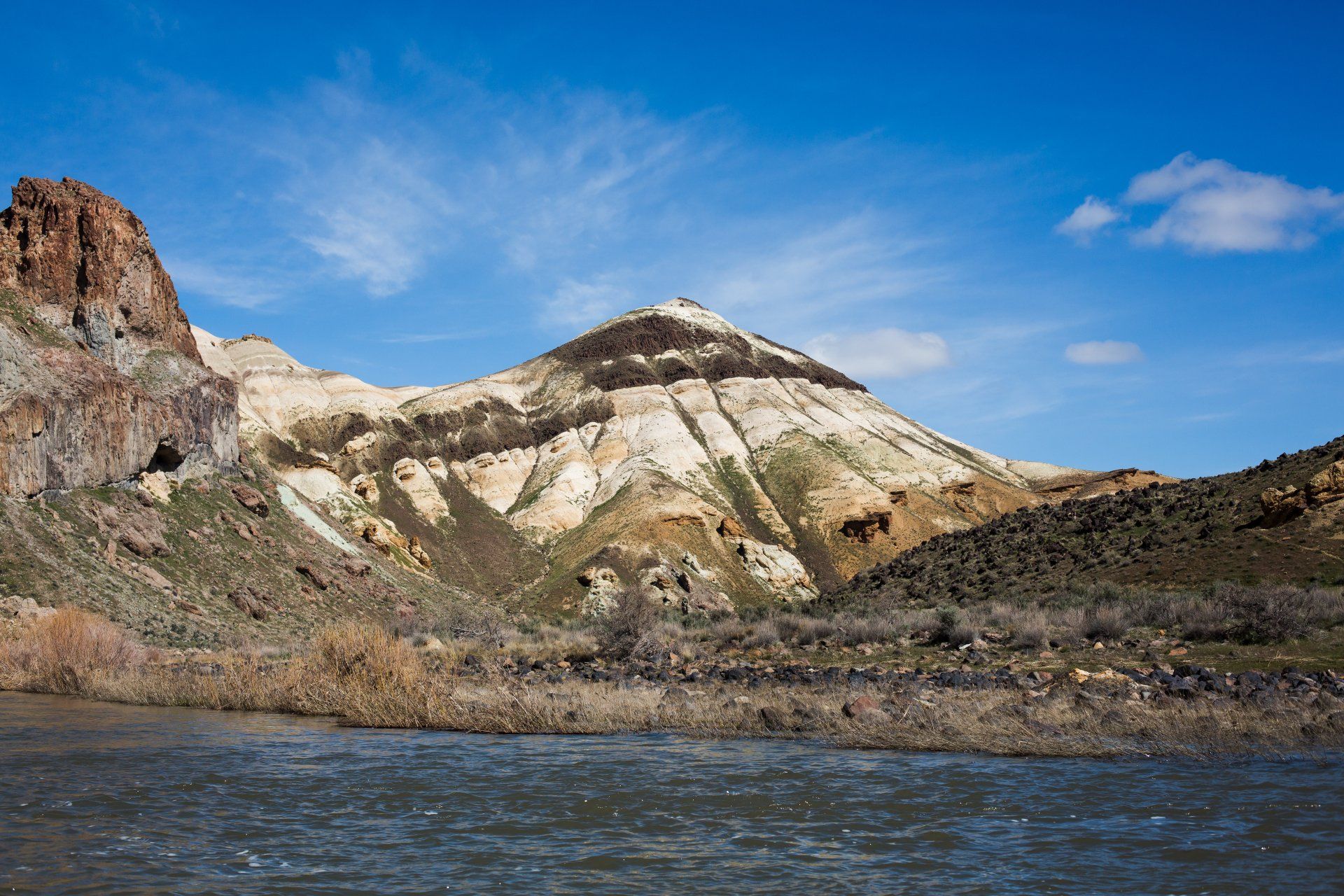
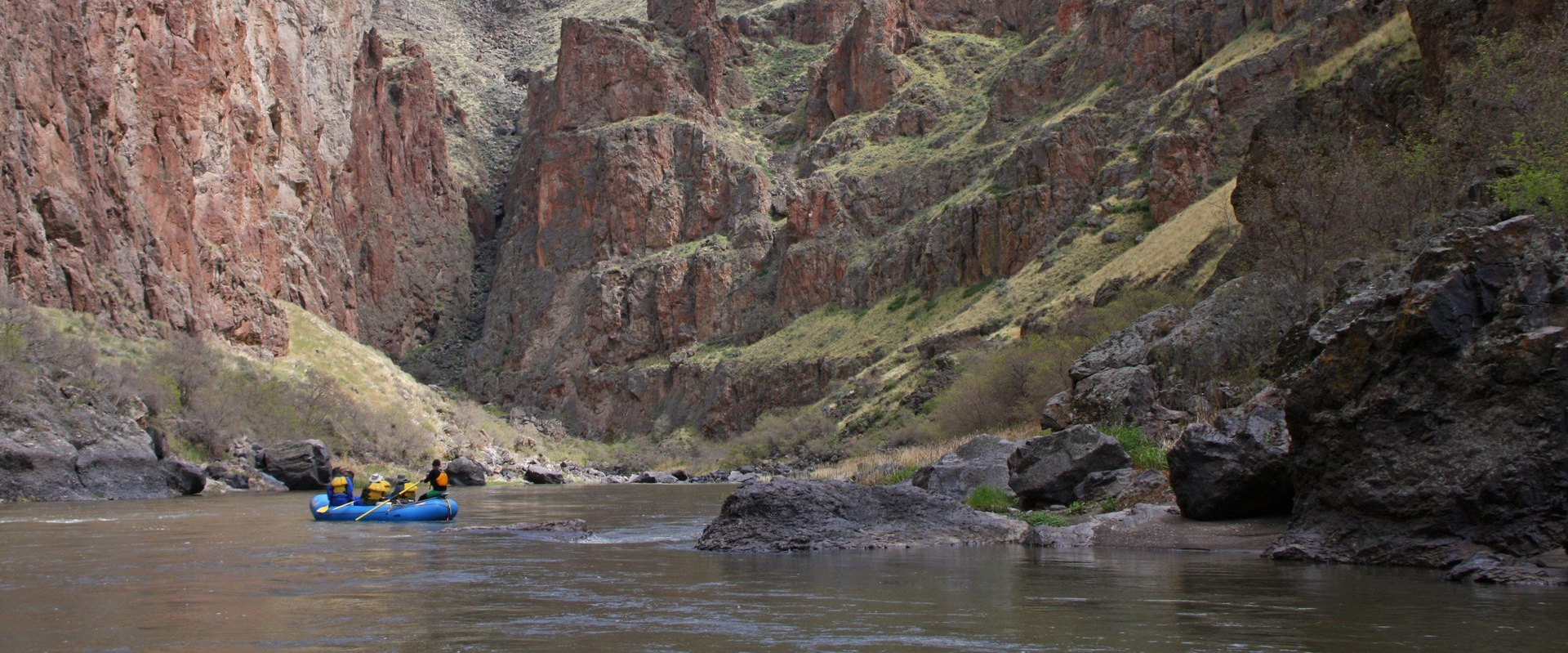
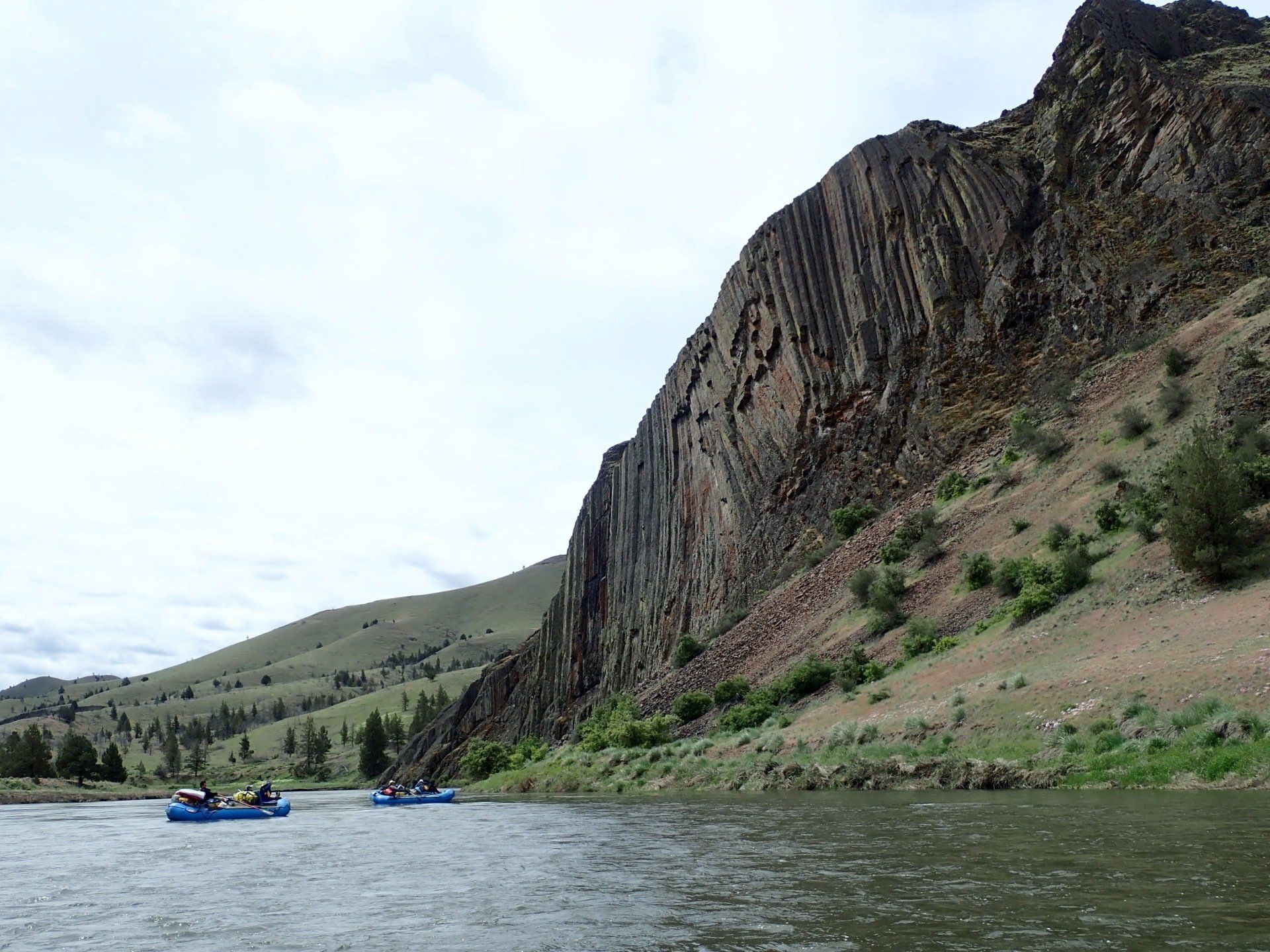
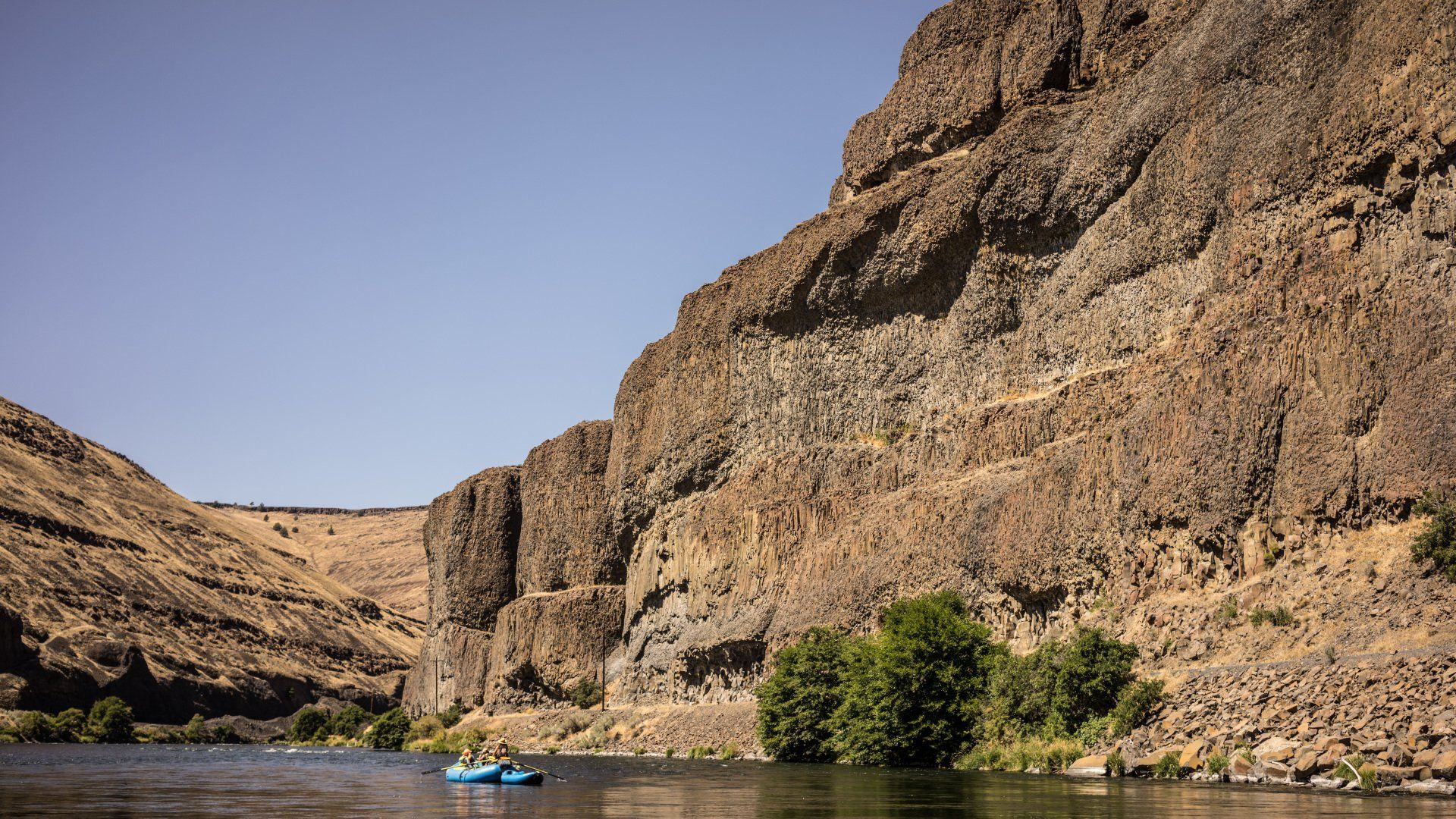
Kyle House is geologic mapping specialist with more than 30 years of professional experience creating geologic maps of beautiful desert landscapes created by rivers, lakes, alluvial fans, volcanos, earthquakes, and landslides. He has worked as a mapper for the Arizona Geological Survey, the Nevada Bureau of Mines and Geology, and the U.S. Geological Survey. Kyle has been mapping the fantastic landscape of the Owyhee River Corridor for 18 years and has logged 100s of miles of foot traverses in the corridor and has floated the river with maps and hiking boots in hand ~10 times. He has also been mapping the lower Colorado River corridor for 25 years and has made maps of a variety of desert rivers including the Humboldt, Walker, Truckee, and Carson Rivers in Nevada, and the Bill Williams, Verde, and Santa Cruz Rivers in Arizona.  He currently lives in Flagstaff, AZ and various field areas. 
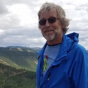
Dr. Gordon Grant

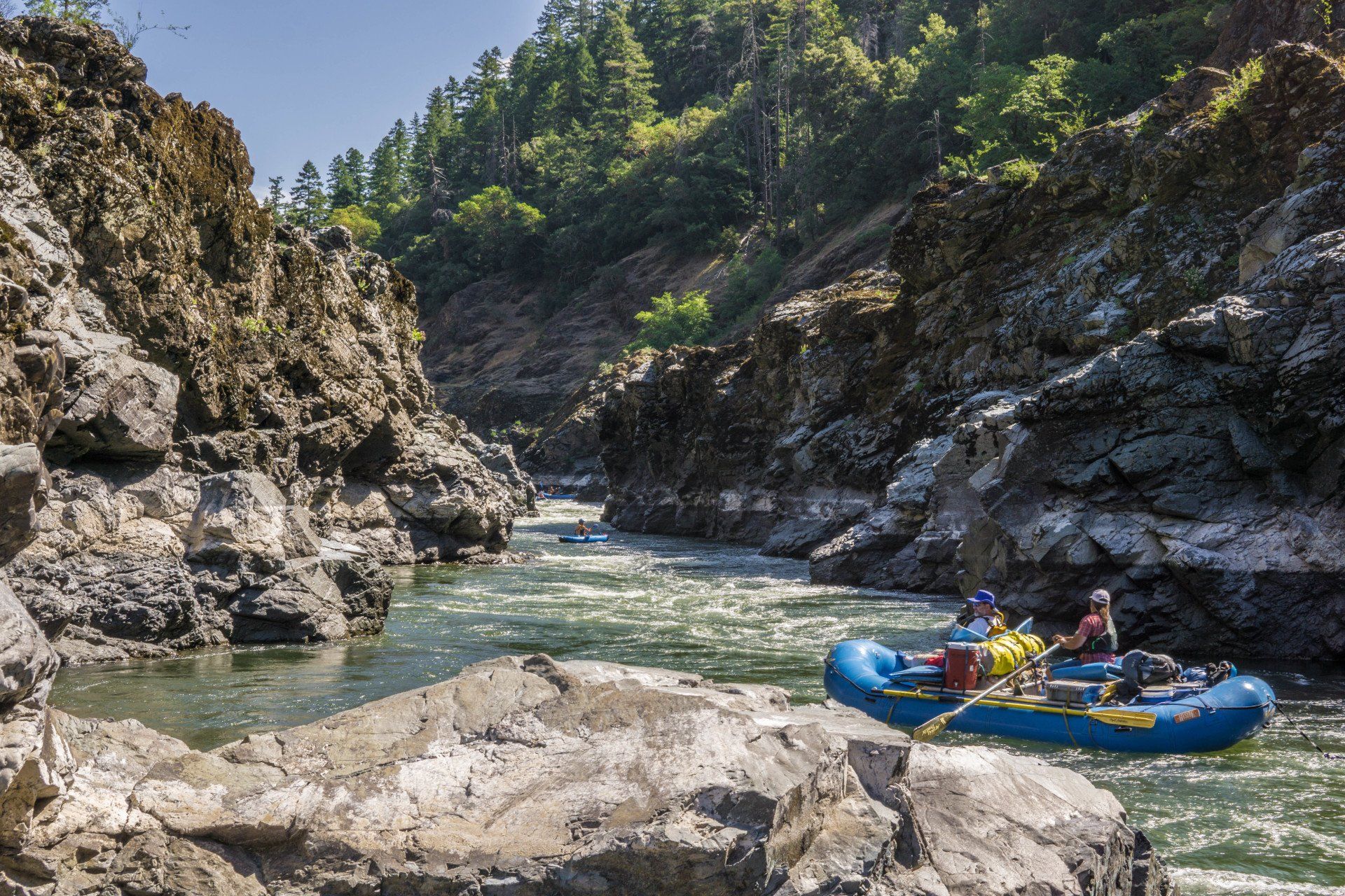
Gordon Grant is a Research Hydrologist with the USDA Forest Service at the Pacific Northwest Research Station in Corvallis, Oregon, USA, and also Courtesy Professor in the College of Earth, Ocean, and Atmospheric Sciences at Oregon State University. Following a decade-long career as a whitewater river guide on western US rivers, in 1985 he began his career with the research branch of the Forest Service with the overarching goal of advancing understanding of how stream networks, watersheds, and entire landscapes respond to changes in streamflow, sediment transport, and wood entrainment. His research has focused on the geomorphic response of rivers to changes in stream flow and sediment transport due to land use, dams and dam removal, volcanic eruptions, and climate change. He is a former Deputy and Associate Editor for the journal Water Resources Research, and a Fellow of the Geological Society of America.
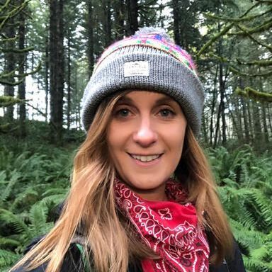
Dr. Emily Cahoon

Emily works in the College of Earth, Ocean, and Atmospheric Sciences at Oregon State University (OSU) and at Isotopx, a mass spectrometry company based out of the UK. Emily has industry experience in the fields of environmental consulting and mineral exploration and her research pursues geochemical, petrologic, and volcanological problems – with an emphasis on magma modification processes and eruption timescales associated with emplacement of Large Igneous Provinces. Her graduate work explored the volcaniclastic deposits of the Clarno and John Day Formation, along with the volcanic history of the Columbia River Basalt Group. Integrating industry experience and research interests, she also operates a small business and is a Registered Geologist here in Oregon. In her free time, Emily enjoys exploring rural post offices with her corgi Regis.


Bill Burgel

Bill retired in 2010 after a successful 40-year career in the railroad industry. Bill worked for several railroads in both the engineering and operating departments. His work for Union Pacific encompassed the design of the first computer-aided dispatching office in the nation. Bill has managed many rail studies for both Oregon and Washington DOTs as well as for TriMet and Sound Transit in Seattle. While working for the railroad, his interest and training in geology was often called upon to resolve landslide issues and rerouting studies, implement early earthquake warning strategies, and conduct numerous long railroad tunnel analyses. Bill has given numerous presentations on rail issues as well as earthquake preparedness and topics pertaining to regional geology to local audiences throughout the Pacific Northwest. 

Share by: